Go Outdoor
ZL190PLUS Land Surveying GPS Review: Accuracy, Features and Who It’s For

Updated · Research-based review – how we review
Disclosure: As an Amazon Associate, GoOutdoor earns from qualifying purchases. If you buy through links on this page, we may earn a small commission at no extra cost to you. Learn more.
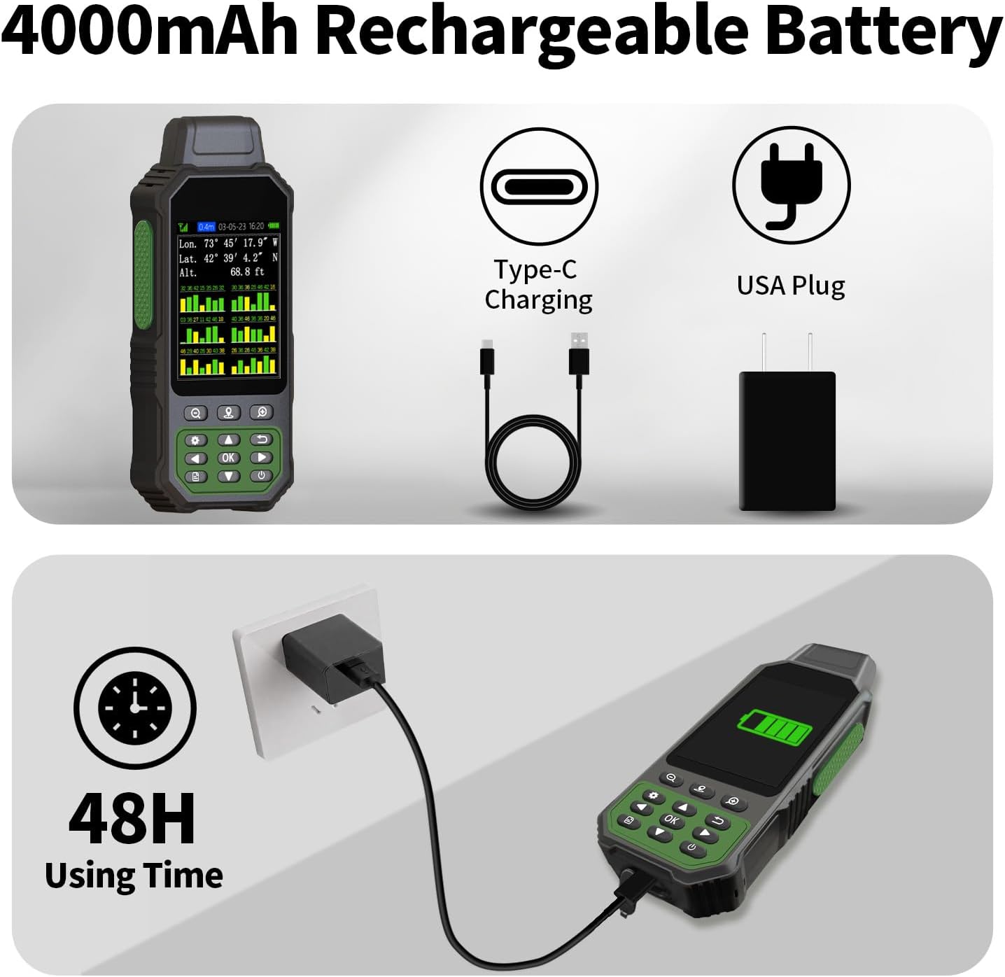




Whether you manage a woodlot, establish paddock fencing on a homestead, or mark out sports turf, relying on an unassisted phone app often introduces drift and drains battery quickly. The ZL190PLUS pairs dedicated multi-satellite positioning with on-device geometry algorithms. Below is an editorial breakdown of what this handheld unit offers, where its limits lie, and how it fits practical land-measurement workflows.
Who It’s For / Who Should Skip It
Who it’s for:
- Landowners, smallholders, and groundskeepers who need direct on-device calculations for parcel area, perimeter length, and slope grade.
- Users working in open fields or rural plots who want multi-GNSS tracking on a dedicated 3.2-inch screen without relying on cellular data.
- Anyone seeking an affordable field-measuring alternative to high-end industrial survey rigs for non-legal planning work.
Who should skip it:
- Hikers and trail runners who need topo basemaps and wrist-based navigation – a dedicated outdoor watch such as the Garmin Instinct is far more practical for trail tracking.
- Licensed land surveyors requiring certified sub-centimeter RTK base-and-rover accuracy for deed registration or legal property disputes.
Key Features: What the ZL190PLUS Delivers
Unlike consumer recreation GPS units that focus on GPX waypoints and elevation profiles, the ZL190PLUS incorporates land-focused measuring algorithms directly into its software.
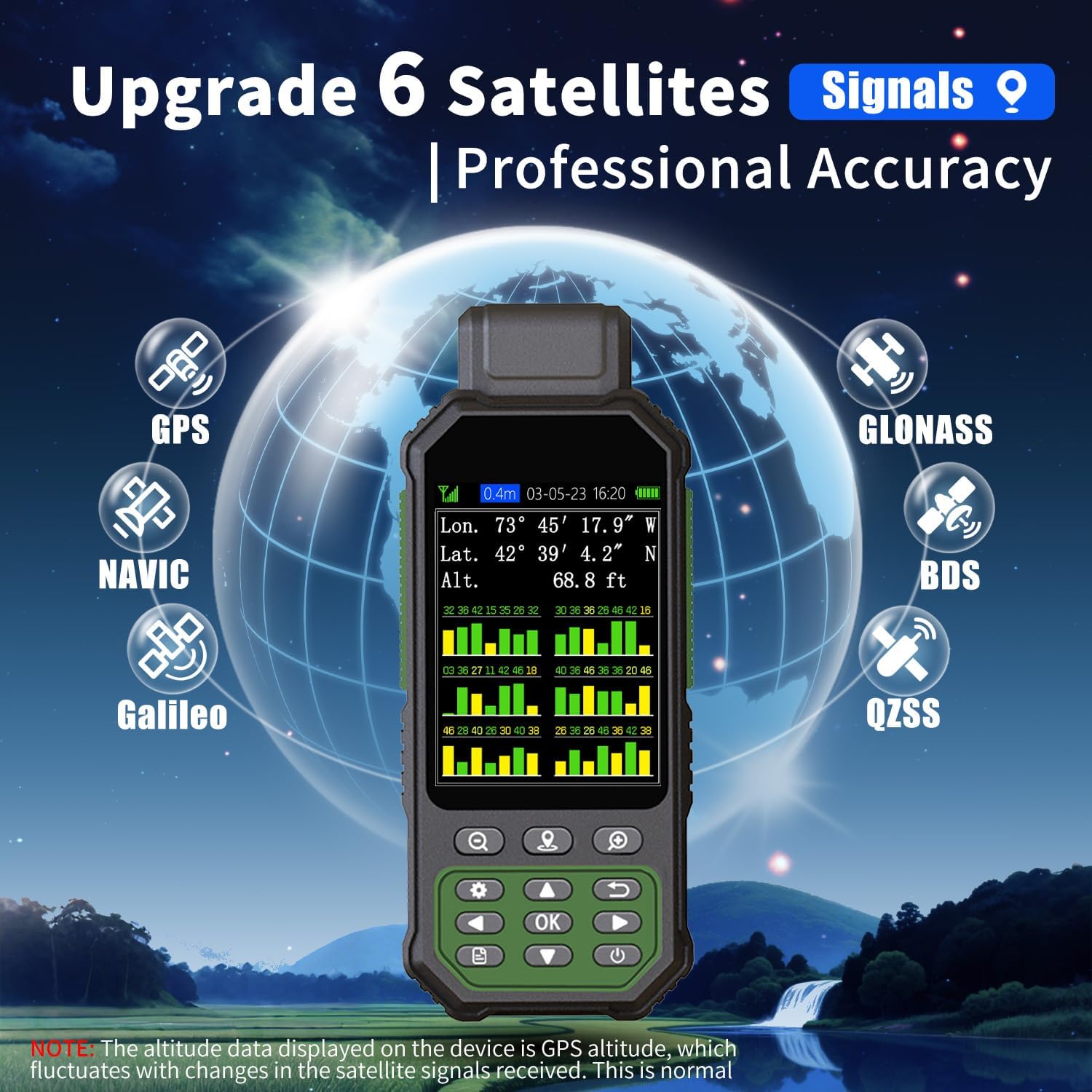
- Multi-GNSS Satellite Support: The receiver connects across GPS, GLONASS, Beidou, and Galileo satellite networks. Accessing multiple constellations improves satellite geometry and positional lock in open terrain.
- 3.2-Inch Color Display: The color LCD screen provides immediate visual feedback of perimeter tracks, coordinate readings, and computed land area under ambient daylight.
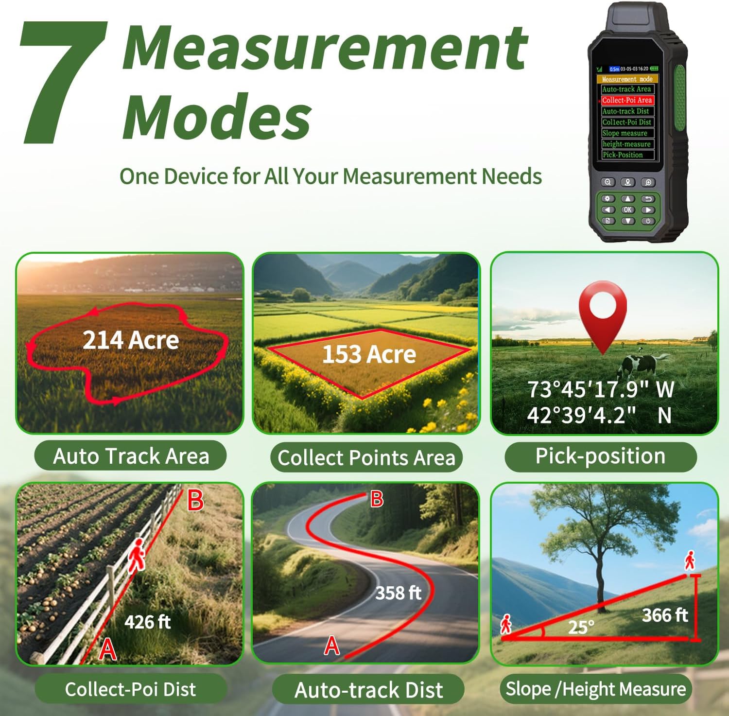
- 7 Built-in Measuring Modes: The device includes specific modes for measuring flat area, slope area, path length, and saved coordinate points without requiring external desktop software.
- Self-Contained Field Operation: Designed as a rugged handheld device, it eliminates the need to rely on smartphone mapping apps or external mobile internet connections in remote sections.
Product Specifications
| Specification | Details |
|---|---|
| Model | ZL190PLUS Handheld GPS |
| Display | 3.2″ Color LCD Screen |
| Satellite Constellations | Multi-GNSS (GPS, GLONASS, Beidou, Galileo) |
| Measurement Functions | Area, Length, Slope, Coordinates (7 Measurement Modes) |
| Form Factor | Rugged Handheld Field Unit |
Comparison: ZL190PLUS vs. Consumer Outdoor GPS
While you will find handheld recreational navigators and sports trackers reviewed at GoOutdoor.us, land-measuring units serve a fundamentally different workflow.
| Feature | ZL190PLUS Land Surveying GPS | Standard Handheld GPS |
|---|---|---|
| Primary Focus | Area, perimeter, and slope calculations | Waypoint routing and trail navigation |
| Slope Calculation | Built-in slope measurement mode | Elevation profile only (usually no land-area slope adjustment) |
| Multi-GNSS Support | GPS, GLONASS, Beidou, Galileo | Often limited to 1 or 2 systems on entry-level models |
| Legal Boundary Certification | No (suitable for estimation & planning) | No (navigation only) |
Practical Operating Considerations
When selecting a field measurement tool like the ZL190PLUS, understanding satellite limitations is essential for getting consistent results:
- Autonomous GNSS vs. RTK: Handheld multi-GNSS units provide practical yard and field estimations. However, they do not use dual-frequency RTK differential base stations, meaning accuracy can vary based on cloud cover, atmospheric delay, and terrain obstruction.
- Canopy Interference: Heavy tree cover or tall building walls can induce multipath interference. For the most reliable boundary plots, walk perimeters with minimal overhead blockage.
- Practical Estimates: This tool is well suited for planning irrigation, calculating fertilizer coverage, sizing pastures, or laying out sports fields, but official boundary disputes always require a state-licensed surveyor.
Field Tips for Best Measurement Accuracy
- Establish Satellite Lock First: Power on the device in an open area with an unobstructed view of the sky. Allow the multi-GNSS receiver 2 to 3 minutes to acquire satellite almanac data before beginning a track.
- Walk Consistent Perimeters: When calculating area, maintain a steady pace around the perimeter corners and pause briefly at turning points to let coordinates settle.
- Utilize Slope Mode on Hillsides: Standard horizontal GPS traces underestimate true surface area on steep terrain; engage the built-in slope mode when measuring sloped pastures or hillside plots.
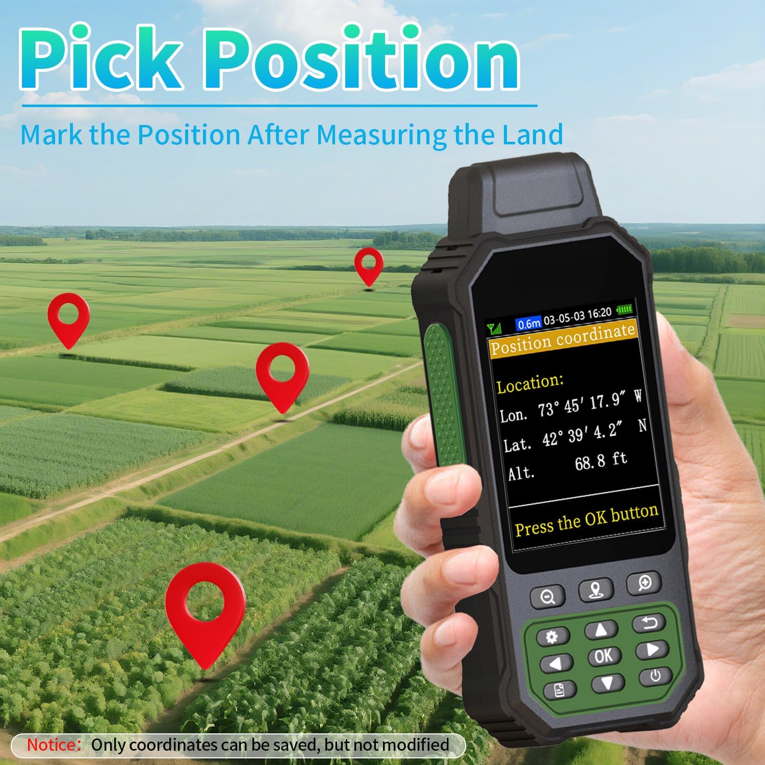
- Log Key Waypoints: Store coordinate points for fixed physical benchmarks (such as fence posts or corner stakes) to cross-reference perimeter walks over time.
Frequently Asked Questions
Is the ZL190PLUS difficult to operate?
The interface is designed around direct measurement tasks, allowing users to select area, length, or coordinate capture without navigating complex GIS menus.
Does the ZL190PLUS require a cellular connection to work?
No. It communicates directly with overhead GNSS satellites (GPS, GLONASS, Beidou, and Galileo), allowing autonomous field calculations in off-grid rural locations.
Can this device be used for agriculture and forestry?
Yes. Sizing fields, planning fence lines, checking acreage, and estimating work zones for planting or clearing are primary use cases for this handheld unit.
Can the ZL190PLUS legally settle property line disputes?
No. Handheld consumer GNSS tools provide practical estimates for planning and maintenance. Legally binding boundary lines require official surveys conducted by a licensed surveyor with calibrated, certified equipment.
The Final Verdict
The ZL190PLUS Land Surveying GPS provides property owners, farmers, and outdoor managers with a specialized alternative to general consumer GPS trackers. By providing on-device area, length, and slope calculations alongside multi-GNSS reception and a 3.2-inch display, it streamlines land-planning tasks without requiring complicated post-processing software.